When in 1788 the austrian government wanted a better map of the regions surrounding Milan and Mantua, which were then subject to the austrian empire, the job was given to the astronomers of the Brera Astronomical Observatory.
The Observatory was at the time the only scientific institution in the region with the structure, people and means to take on such a feat: astronomers had a long tradition of measuring the latitude and longitude of specific points on Earth by measuring the position of stars; they knew how to build and use the precision instruments needed to measure angles and distances; and they could better organize their observations to cover the entire region that was going to be put on the map.
At the time measuring latitudes and longitudes was done with instruments such as pendulum clocks and the repeating circle, displayed in the Museum of the Observatory, which were built built by the German scientific instrument maker Georg Friedrich von Reichenbach. These instruments were too bulky and too heavy to take along in the fields; therefore they used a different method to measure the positions of roads, lakes and mountains: the geodetic triangulation, a method that had already been used successfully by other astronomers (Cassini for the map of France) and was the only known accurate measuring technique, before the invention of GPS. The technicians of the Observatory built much lighter and portable instruments like the quadrant and the geodetic bars; with the help of these instruments the astronomers started their measuring campaign in Lombardy, working in every kind of weather and on every kind of terrain.
But how did this method work?
The region that needed to be mapped was divided in triangles with sides of a few miles and vertices in places that could be seen easily from a distance, like towers, bell towers or the tops of mountains. The astronomers would then measure the angles at these vertices and use trigonometry to derive the whole geometry of the grid.
Before all this the astronomers measured a geodetic base, about 10 km long (Precisely 9999,19 meters) going from north to south near the town of Somma Lombardo, an extremely flat piece of land where there is now the Malpensa Airport.
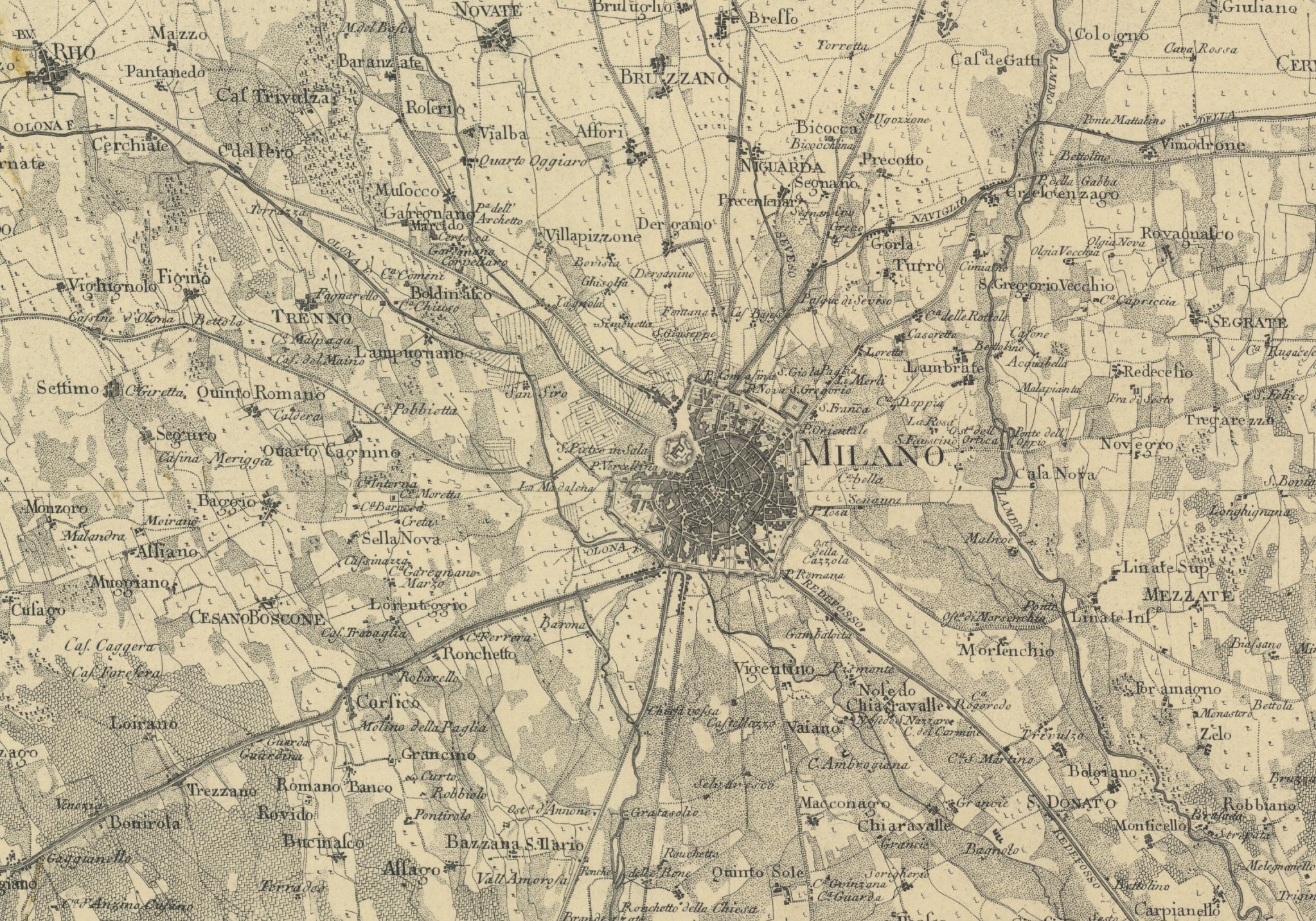
The campaign lasted until 1794. All the data was then given to geographer Giacomo Pinchetti, who drew the new map of the region. From it, the engraver Benedetto Bordiga prepared copper plates to be used to make printed copies of the map. All this came to an abrupt stop in 1796, when Napoleon arrived in Italy with his military forces. To preserve the metal plates from the enemy, the austrian armies removed them. The plates were given back to the Observatory in 1804, but only a few copies of the map were printed.
The astronomers also took several measurements to aid in drawing a detailed map of Milan, needed for a renovation of the city center that was never completed.
The measurements of the base taken near Somma Lombardo were repeated several times: the last measurement, taken by the Military Topographic Institute in 1894, gave a length of 999,54 meters. After that, wood grew in the area, and the airport and a prison were built nearby, making it impossible to take further data.